Ethics in Geo
This year I was invited to speak at FOSS4G, the premier conference for open source geospatial tech. Then, of course, everything happened and the conference isn’t. It’s a pity – I was really excited for it and very thankful that the organizers were willing to take a chance on me, despite my several years of remove from the industry. I had chosen a topic that’s near to my heart and also might benefit from a little distance. Not being one to leave scraps on the shop floor, here are some of the ideas: on ethics in geospatial software.
The only new market is ads
Part of the optimism of the early 2010s in geo was the sense that we might uncover new markets: that the old markets of oil & gas, real estate, military, and government could be supplemented by something new. Maybe individual farmers would benefit from real-time data, or social apps like Foursquare would be map-first. There had to be money somewhere.
Ten years later, the only new market is advertising. Google Maps became a platform for advertising. Everyone else learned that passive location tracking (’telemetry‘) was a nice complement to their consumer behavioral analysis.
With the exception of high-end niches like hiking maps, consumer geospatial is an ad-supported industry. You can argue about whether ads can be ethical, but there’s little debate that they currently aren’t: targeted advertising is currently as personal and invasive as is legally allowed, and the USA sets almost no limit. All of the data that is collected and ‘anonymized’ by ad-tech is potentially re-identifiable, as I wrote in 2018, and geospatial is even more-so than most forms.
It’s hard to overstate the influence of intelligence & oil in geo
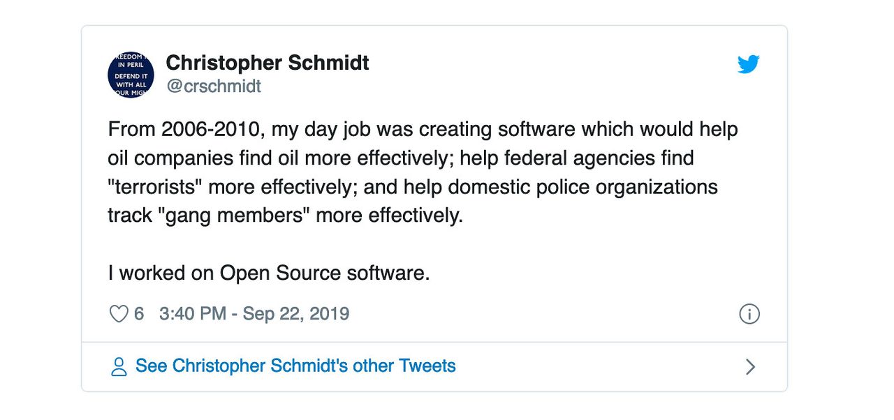
I admire Christopher’s openness about this, and have a few minor stories of my own. Here’s one of them.
In 2011, I worked on a specification called MBTiles, which stored image files of parts of a map - map tiles - in an SQLite database, which could conveniently be stored as a single file. Basically the problem we were trying to solve was that FAT filesystems had problems storing thousands of files and that writing thousands of files to a disk or transferring them across the web had really high overhead. So we just wanted one file that we could use without unzipping or unpacking: hence, MBTiles. It was a silly solution to a silly problem and it succeeded because we didn’t overthink it.
A little while later, the OGC reached out about standardizing MBTiles, or something like it. It was the latter: they wanted something a lot more complicated. I, at 24 and with a serious disdain for meetings, was included in the meetings. The whole direction of the project, what would become GeoPackage, was really hard to follow: the web apps and open source tools that I could imagine had no need for a lot of the things that were passed down as ‘requirements’ from the people who were footing the bill.
Eventually, there was a proposal for a certain table to be included with some XML data indicating cloud cover, with a PDF linked from some military site. Then folks started referring to imagery from ‘the bird.’ I was around then I realized we were designing a format for imagery to be sent from drones to soldiers.
A bunch of readers probably called that one. Looking at the list of OGC members, you can see the military industrial complex in full force: we’ve got the Army, Lockheed, the Australian DoD, DHS, the NGA, and a whole lot of awkwardly-named defense contractors. There are plenty of open secrets about satellite companies with ≥ 50% revenue from defense and agencies running private copies of OpenStreetMap technology to manage their data.
Oil & defense, of course, haven’t just been consuming software or taking advantage of our hard work. Our system of projections & datums is largely thanks to oil money - originally the European Petroleum Survey Group - the EPSG in EPSG, and now the International Association of Oil & Gas Producers. Without In-Q-Tel, there’s no Keyhole, so no Google Earth or KML. Without dependable intelligence contracts, who knows if Maxar’s constellation of satellites would exist. Or GPS.
But the fact that these interests were so involved in the modernization of the field and are now the largest and most profitable contracts to win shouldn’t be reason to accept them indefinitely.
Doing things is possible
I think that this is bad: that the military-industrial complex is either straightforwardly bad, or at least not good enough that you should donate your time to them. But we all have been donating our time to them, via open source software.
There are ways to change the status quo. Consider ethos licensing, which has been extremely divisive. But do yourself a favor by reading lawyers instead of commenters: Heather Meeker’s skeptical take and Kyle Mitchell’s more positive one. Ethos licensing is a way of using the power of copyright to do more than just protect your rights or give them away: it’s the idea that you could prevent human rights abusers from using your work via legal means.
It probably won’t work, at least how you would hope. We’re in the age of legal realism, in which power and money matters more than the letter of the law. And you probably shouldn’t call it ‘open source’ because the OSI, the organization that controls the term (somehow?) says that ethos licensing isn’t open source. But using an exotic license would work in the case of large companies which have explicit lists of allowed & banned licenses, like Google.
There’s a lot more
This is the facet of ethics in geo that’s been on my mind recently, alongside the pressing need to recreate from the ground up the American police system. But there is so much more and I don’t want to give some blasé ‘read critical theory’ take here. For starters, there’s the representation problem in which maps only show legal and political boundaries and make it easy to forget recently-murdered native peoples. And the terrifying ease of re-identification of most ‘anonymous’ datasets, something that only a handful of experts know how to resolve.
How about you?
I want to be clear about who this is for. Some folks are working for ethically fishy organizations trying to make them better, and some might be right. Some people need to hold down a steady job because they have a family and a mortgage. Some people just love writing code that will be useful to others.
When I was working in geo, I mainly fit into that last bit: fortunate enough to know I could be making a little more if I risked my ethics but that I didn’t need it. The folks in that situation are the ones I judge the most, who are the most similar to me, the ones who have lots of options and knowingly take the one where you’re making the world worse. Why?
For the rest of us, the folks who work on open source software or for companies that make software, the question gets harder. Without ethos licensing, anyone can use the things I write. And while once I wondered who would benefit from that technology, now I know: journalists, sure, and neat startups, and some commercial software outfits.
But there’s no question of whether parts of the military and the oil industry use open source geospatial software, they do. We can only wonder whether the most reprehensible parts, like Border Patrol, an organization that had one officer or agent arrested per day from 2005 to 2012, are also using it. Our complicity is limited: without intention, sure, but no longer without knowledge. And until we figure out ethos licensing or something similar, there’s no way to stop it.